Mt. LeConte on Twitter: twitter.com/MtLeconte
There are five beautiful trails that lead to Mt. LeConte. Convenient parking lots are located at each trailhead.
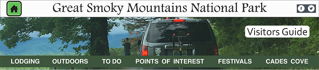
Alum Cave Trail
Start at the Alum Cave parking area on Newfound Gap Road (Hwy 441 between Gatlinburg, TN and Cherokee, NC) 8.5 mi. south of Park Headquarters and Visitors center. Distance to LeConte Lodge: 5.5 miles. Net climb: 2560 feet. Although fairly strenuous on the ascent, it is the easiest return from the summit. At the lower portion see Alum Cave Creek, Arch Rock, Alum Cave Bluff (an excellent overlook) at 2.3 miles and National Park Service interpretive signs. At the upper portion, below Cliff Top, is a narrow cleft across a steep open slope with cables installed for hand holds. In winter this part of the trail may be choked with ice hummocks covering the cables so use extra caution. Note the large red spruce and tulip trees along the way and flowering rhododendron in late June.
Alum Cave Trailhead; image by Jeaneane Payne
The Boulevard Trail
Start at the Newfound Gap parking lot (Hwy 441 between Gatlinburg, TN and Cherokee, NC). You will follow the Appalachian trail for 2.7 miles to the junction where the Boulevard Trail branches left (N). total distance to LeConte Lodge: 7.8 miles. Net climb: 1080 feet. The Boulevard Trail is a rolling trail following a narrow ridge with step forested slopes on both sides; the trail is steep at the final ascent to LeConte Lodge. You may occasionally encounter ice and snow in early Spring and late Fall on this trail. An interesting side trail just past the junction with the Appalachian trail leads right 0.4 miles to the top of cliffs at the Jumpoff, with striking view of Charlie's Bunion and upper Greenbrier Cove. Myrtle Point and CliffTop offer other excellent views. Note red spruce and balsam firs along the way.
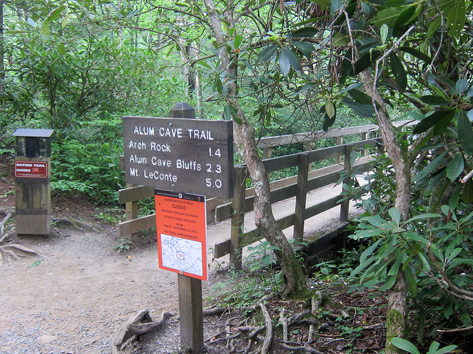
Bullhead, Rainbow Falls, and Trillium Gap Trailheads; image by Jeaneane Payne
Bullhead Trail
Start at the Rainbow Falls - Bullhead parking lot at 3.4 miles on Cherokee Orchard Road, a one-way road. Distance to LeConte Lodge: 7.1 miles. Net climb: 3820 feet. Rainbow Falls Trail, which originates at the same parking lot, rejoins Bullhead at mile 6.4. Fine lookoffs at the Bullhead and a heath bald. Caution: No water along the trail so carry a canteen. Note red spruce and balsam firs along the way, and the Bullhead Heath for spring blooms, and the Bullhead Trail for magnificent autumn scenery.
Rainbow Falls Trail
Start at the Rainbow Falls - Bullhead parking lot at 3.4 miles on Cherokee Orchard Road, a one-way road. Distance to LeConte Lodge: 6.7 miles. Net climb: 3820 feet. Bullhead trail, which originates at the same parking lot, rejoins Rainbow Falls Trail at mile 5.8. Note Rainbow Falls at mile 2.4. LeConte Creek forcibly erupts over the rocks and can freeze solid in the water. See impressive overlooks at 5.0 miles. In late June, Rocky Spur is a good place for flowering rhododendron.
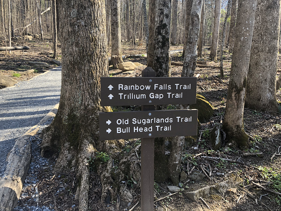
Trillium Gap Trail; image by Jeaneane Payne
Trillium Gap Trail
Start at the Grotto Falls parking lot at mile 1.7 on the Roaring Fork Motor Nature Trail (a one-way road closed in winter). Distance to LeConte Lodge: 6.5 miles. Net climb: 3300 feet. See Grotto Falls at mile 1.5. Note Roaring Fork Creek, one of the steepest streams in the park. Also note red spruce and, at higher elevations, fraser fir. As you walk the trail between Grotto Falls and Trillium Gap, listen for underground streams roaring through the rocks.
| Trip Ideas Great Smoky Mountains Facts Institute at Tremont Transportation & Airports Local News Photo Tours • Fall Photo Tour • Roaring Fork Motor Nature Trail • Smoky Mountain Fall Foliage • Fall Foliage at Kuhowi • Fall Colors in nearby towns • Fall in Wears Valley • Best Fall Hikes |
WHAT TO DO Attractions Biking Fishing Hiking Outdoor Adventure Scenic Drives Shopping Heritage, History, & Culture Nature Activities 4 SEASONS Winter Spring Summer Fall WEDDINGS Wedding Services Honeymoon Cabins |
WHERE TO EAT Restaurants Farmers' Markets Recipe Cards Surrounding Towns: • Cherokee • Gatlinburg • Pigeon Forge • Townsend • Wears Valley CONTACT |
||