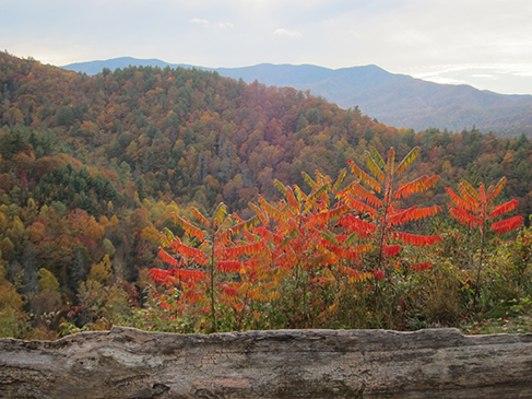
Cataloochee Driving Trail is located in Cataloochee Valley. Nestled among some of the most rugged mountains in the southeastern United States, you will discover Cataloochee Valley.
Surrounded by 6,000-foot peaks, this isolated valley was the largest and most prosperous settlement in what is now Great Smoky Mountains National Park. Once known for its farms and orchards, today's Cataloochee is one of the most picturesque areas of the park.
 |
 |
 |
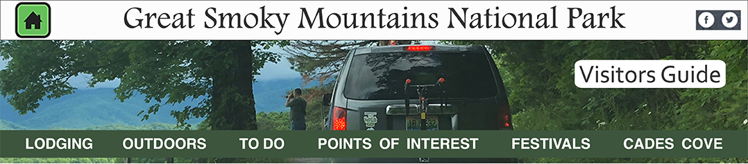
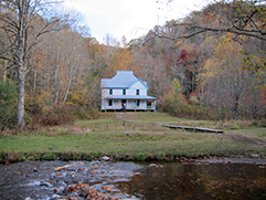
Caldwell Place |
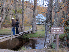
Caldwell Place | Mountain Stream |
 |
 Road to Cataloochee |
|
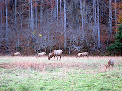
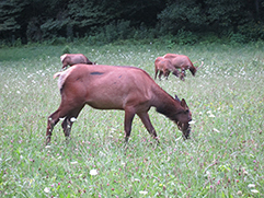
| Elk in Cataloochee | ||
 |
||
| Elk in Cataloochee | ||
Highlights:
• Historic buildings: Cook Cabin reconstructed in Little Cataloochee
• Fishing: Pick up fishing regulations at a park visitor center. A Tennessee or North Carolina fishing license is required to fish within park boundaries. A fishing license may be purchased in a nearby community.
• Camping: A primitive campground with 27 first-come, first-served sites. Open mid-March - October. Tent or RVs up to 31 feet.
• Hiking: There are many enjoyable trails to hike in Cataloochee. Several of these designated backcountry campsites (camping by permit only) are along many of these trails.
• Horse camp: Call (800) 365-2267 or Make a reservation online.
• Wildlife viewing area
Directions: From I-40, exit at North Carolina exit #20. After 0.2 mile, turn right and follow the signs 11 miles into Cataloochee Valley. To get there from Oconaluftee or Cherokee, take the Blue Ridge Parkway to Highway 19. Follow 19 (toward Asheville) through Maggie Valley. Turn left onto Highway 276 N. Just before the entrance ramp to I-40 (but past gas station), turn left and follow the signs 11 more miles to Cataloochee.
Cataloochee historic buildings
| Trip Ideas Great Smoky Mountains Facts Institute at Tremont Transportation & Airports Local News Photo Tours • Fall Photo Tour • Roaring Fork Motor Nature Trail • Smoky Mountain Fall Foliage • Fall Foliage at Kuhowi • Fall Colors in nearby towns • Fall in Wears Valley • Best Fall Hikes |
WHAT TO DO Attractions Biking Fishing Hiking Outdoor Adventure Scenic Drives Shopping Heritage, History, & Culture Nature Activities 4 SEASONS Winter Spring Summer Fall WEDDINGS Wedding Services Honeymoon Cabins |
WHERE TO EAT Restaurants Farmers' Markets Recipe Cards Surrounding Towns: • Cherokee • Gatlinburg • Pigeon Forge • Townsend • Wears Valley CONTACT |
||