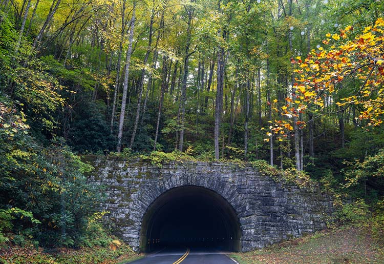

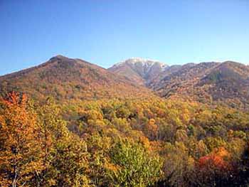
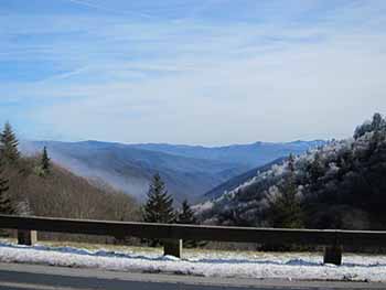
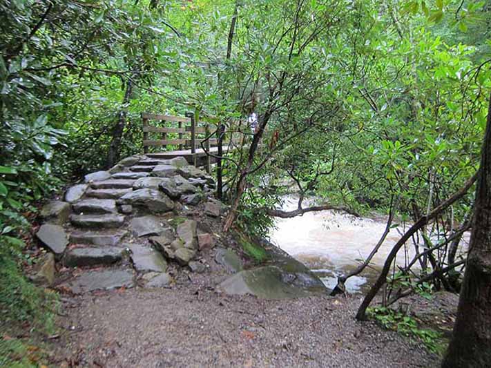
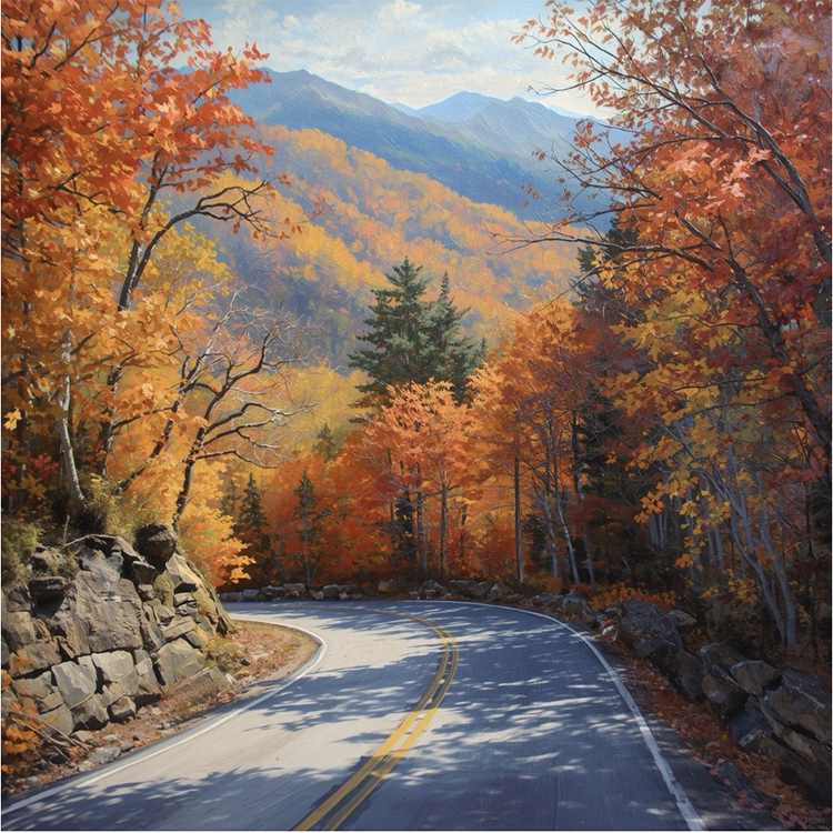
Great Smoky Mountains National Park encompasses over 510,000 acres and features 16 breathtaking scenic drives. Panoramic views of the park can be seen on some of the park's roads as well as beautiful mountain streams, historic buildings, and uninterrupted forest.
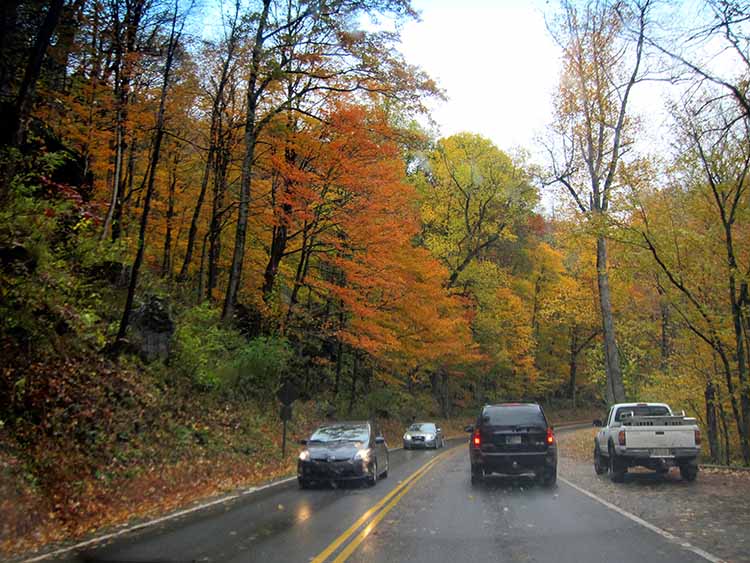
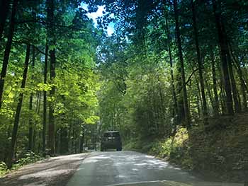
There are over 270 miles of road in the Smokies, most of which are paved. The gravel roads are maintained in suitable condition for standard vehicle driving. Travel times on most roads will average 30 miles per hour.
On a scenic drive, you will need to shift to a lower gear when going downhill to conserve your brakes and avoid brake failure. Keep extra distance between you and the vehicle in front of you and watch for sudden stops or slowdowns. Slower drivers should use pullovers frequently to allow other vehicles to pass. This will enable traffic to flow more smoothly throughout the Park.
The views you will enjoy are some of the most photographed in America.
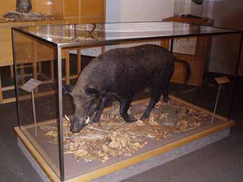
Wildlife, including black bears, wild turkey, coyote, elk, red fox, grey wolves, and deer are often seen throughout Great Smoky Mountains National Park.
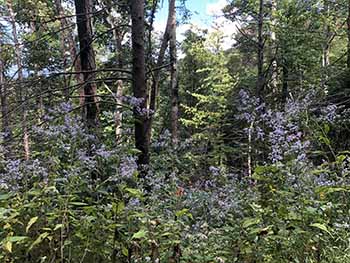
Floral and fauna are in abundance. Please do not pick the wildflowers or disturb other growth in the Park.
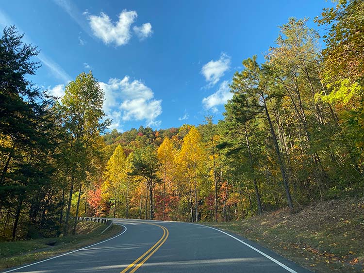
1. Newfound Gap Road
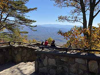
Newfound Gap Road (33 miles, paved.) This highway crosses Newfound Gap and connects Cherokee, NC and Gatlinburg, TN. Highlights include numerous pullovers with breathtaking mountain views and a variety of forest types as you ascend approximately 3,000 feet up the Great Smoky Mountains. Newfound Gap has a large parking area, scenic views, restrooms, wayside exhibits, and the Rockefeller Memorial.
At Newfound Gap you will have access to The Boulevard Trail which will take you to Mt. LeConte.
 |
 |
 |
|
2. Clingmans Dome Road
Clingmans Dome Road (7 miles, paved.) This road is a short distance from Newfound Gap and follows a high ridge to a paved trail that leads 0.5 mile to the park's highest peak. The scenic mountain views are the most beautiful views in the Smoky Mountains. The cool damp spruce-fir forest is similar to the boreal forest of Canada. Clingmans Dome Road also provides access to the Appalachian Trail.
 |
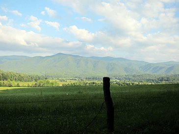
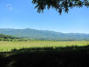
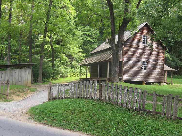
3. Cades Cove Loop Road
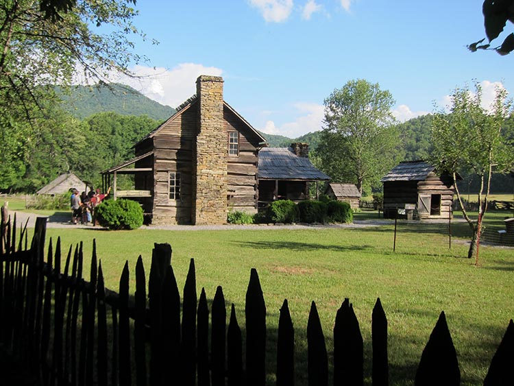
Cades Cove Loop Road is an 11-mile drive through lush valley surrounded by mountains. This is one of the most popular destinations in the Great Smokies. It is a peaceful driving tour and is used for bicycling. Throughout the Cove you will see historic buildings, including rustic log homes of original residents of the Cove, several churches, an old mill, molasses making equipment, and cemeteries.
 |
 |
 |
 |
 |
|
4. Little River Road
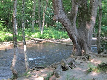
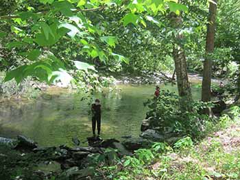
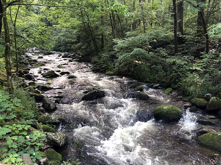
Little River Road (18 miles, paved) parallels the Little River from Sugarlands Visitor Center at the Gatlinburg entrance to the park to Townsend, Tennessee. Highlights of Little River Road include the cool mountain river, wildlife viewing, waterfalls, and wildflowers. Little River Road ventures through Elkmont, Metcalf Bottoms, The Sinks, and Meigs Falls
.
 |
 |
 |
|
5. Roaring Fork Motor Nature Trail
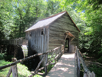
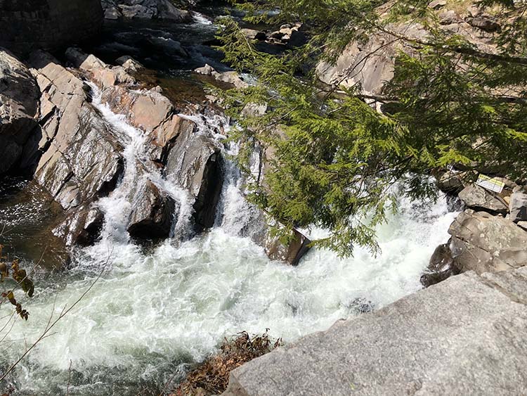
Roaring Fork Motor Nature Trail is a favorite driving trail in the Smoky Mountains. Rushing mountain streams, old-growth forest, well-preserved log cabins, grist mills, and other historic buildings can be seen along the trail. One of the log cabins is the Noah "Bud" Ogle Place which offers a self-guided walking tour of this authentic mountain farmstead and surrounding hardwood forest. You will also see a steamside tubmill and the Ogle's handcrafted wooden flume plumbing system.
Just beyond the Rainbow Falls trailhead you have the option of taking the one-way Roaring Fork Motor Nature Trail. This narrow but paved road winds for six miles beside rich forests, waterfalls, and mountain streams. "Roaring Fork" is the name of the stream which the road roughly parallels. It is one of the larger and faster flowing mountain streams in the park. Following a heavy rainfall, you can see why it has this name. A waterfall called Place of a Thousand Drips is a wonderful place to stop along the trail.
 |
 |
 |
|
The trail is accessible at traffic light #8 in Gatlinburg. Follow Historic Nature Trail to the Cherokee Orchard entrance to the national park.
Buses, trailers, and motor homes are not permitted on the motor nature trail.
6. Foothills Parkway West
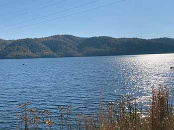
The Foothills Parkway West skirts the park's northern side. Only three sections are currently open to vehicle traffic. This scenic drive stretches along 17 miles and travels along the backbone of Chilhowee Mountain between Chilhowee Lake and Townsend TN. You may view Great Smoky Mountains National Park and the beautiful valleys of the Tennessee River Valley bordered by the plateau of the Cumberland Mountains.
The Parkway is accessible from Walland, Tennesssee which is about 5 miles outside of Townsend.
 |
 |
 |
|
7. Parsons Branch Road
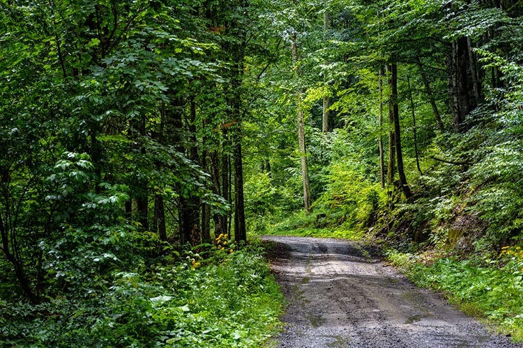 |
Parsons Branch Road. This is an 8-mile gravel road leading from Cades Cove Loop Road to US 129 toward the North Carolina side of the Park and Calderwood Dam. The Road was once a main artery among a complex of roads feeding the smaller coves and hollows with Cades Cove. These highlands coves were home to several mountaineer farmers who stood against Confederate raiders.
There are 19 creek fords on this road, all of which are concreted and easy to cross, but some are nearly a foot deep and may require extreme caution in bad weather. The Park Service closes the gate at dusk, in extreme weather, and in winter (Nov-Apr). Camping is allowed in some places, but a permit is required from the Ranger Station. Check before taking this road. The road is uncrowded, scenic, exciting, and leads to the Tail of the Dragon.
Parsons Branch road is accessed just beyond the Cades Cove Visitors Center. No trailers or RVs are allowed. The drive takes approximately one hour.
8. Cataloochee Overlook
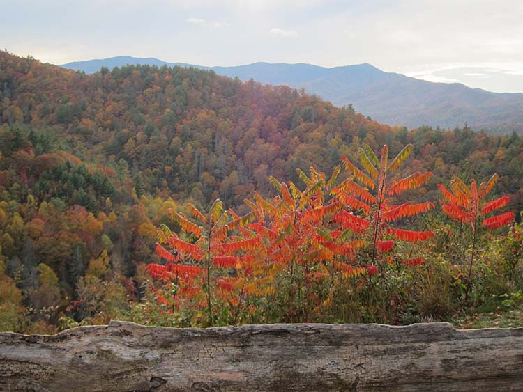 |
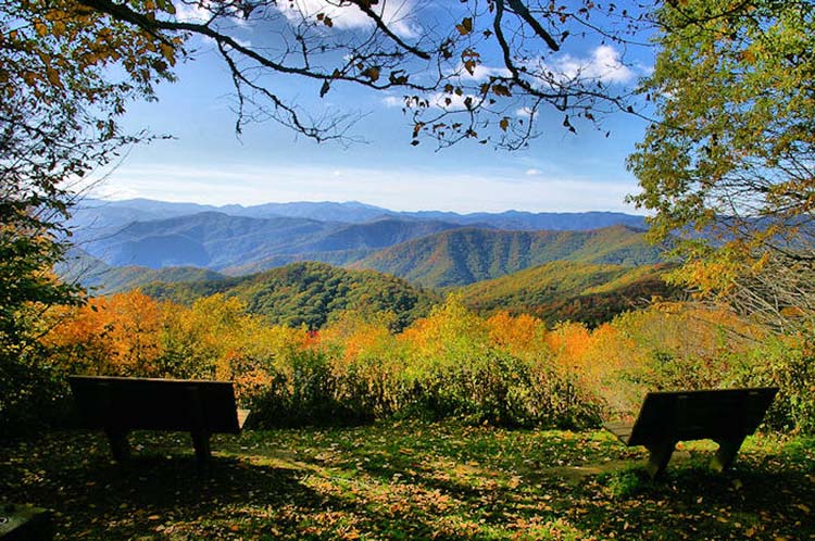
Cataloochee Overlook is one of the most scenic areas of the Park. Cataloochee Valley is nestled among some of the most rugged mountains in the southeastern United States. Surrounded by 6000-foot peaks, this isolated valley was the largest and most prosperous settlement in what is now Great Smoky Mountains National Park.
9. Cataloochee Valley
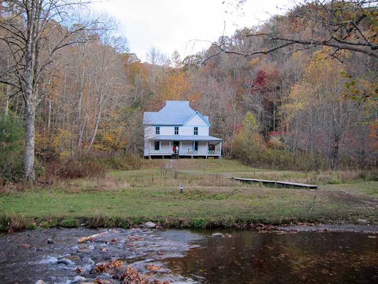 |
Cataloochee Valley is nestled among some of the most rugged mountains in the southeastern United States. Surrounded by 6000-foot peaks, this isolated valley was the largest and most prosperous settlement in what is now Great Smoky Mountains National Park. Once known for its farms and orchards, today Cataloochee is one of the most picturesque areas of the park.
Directions: From interstate I-40, exit at North Carolina exit #20 and travel 0.2 miles on route 276. Turn right onto Cove Creek Road and follow the signs 11 miles into the Cataloochee Valley.
10. Rich Mountain Road
 |
Rich Mountain Road heads north from Cades Cove over Rich Mountain to Tuckaleechee Cove and Townsend, TN. The 8-mile, one-way, gravel road provides beautiful views of Cades Cove.
Many prize-winning photographs come from here. Situated on a dry ridge, an oak-dominated forest lines the roadside. Once outside the Park, the road becomes steep and winding.
11. Balsam Mountain
Balsam Mountain, a majestic peak gracing Great Smoky Mountains National Park, stands as a testament to the enduring beauty and ecological richness of the Appalachian Highlands. Rising to an impressive elevation of 6,310 feet (1,923 meters), it is among the highest peaks in the park, offering breathtaking panoramic vistas that stretch across a seemingly endless expanse of verdant forests and undulating ridgelines. The mountain's name, evocative of the fragrant balsam fir trees that thrive at its high altitudes, hints at the sensory delights awaiting those who venture into its embrace.
 |
||||||||||||||||||||||||
Balsam Mountain; image by GSMNP The slopes of Balsam Mountain are swathed in a dense tapestry of Southern Appalachian spruce-fir forest, a unique and globally significant ecosystem characterized by its cool, moist climate and the presence of red spruce and Fraser fir trees. This high-elevation forest provides critical habitat for a diverse array of plant and animal species, some of which are found nowhere else on Earth. Rare wildflowers, elusive salamanders, and the endangered northern flying squirrel find refuge within this verdant sanctuary.
12. Balsam Mountain Driving Trail
13. Oconaluftee Mountain Farm Museum
14. Fontana Dam
Directions: Follow U.S. 74 west from Bryson City. Turn right at the State Highway 28 turnoff. Follow State Highway 28 until the turnoff to the right for Fontana Dam. From Maryville, follow U.S. 129 south. Turn left at State Highway 28. Go approximately 10 miles to turnoff on left.
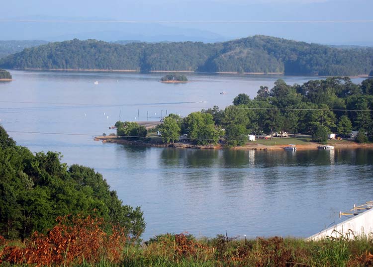
15. Douglas Dam
This lake is not only vital for flood control and power generation but also serves as a popular recreational destination, offering opportunities for boating, fishing, and other water sports. 16. The Road to Nowhere
This road was originally to be built to provide the many residents who gave up their land for the Fontana Dam project access to their ancestral gravesites.
CONTACT |
||||||||||||||||||||||||